Last week I made it to a mountain range that was fast assuming an almost-mythical status in my mind: The Cobberas. Along the way I learnt some important lessons. Finding out a little bit about your destination before heading off can sometimes be helpful, species distributions don't follow state boundaries and bushes with spikes will always win.
The Cobberas range sits just on the Victorian side of the border with NSW, and is contained within the Cobberas Wilderness Area. I drove there from Canberra, with my Dad, along the Barry Way - this is one amazing drive! I was completely unprepared for the desert-like environment that we entered so soon after leaving the alpine gateway town of Jindabyne. Red earth, woody scrub, no undergrowth to speak of. And very very dry. As we entered the Snowy River valley, the landscape began to change and as we finally made our way into the Cobberas region it once-again resembled something verging on what I think of as 'montane'. The purpose of this trip was to look for grasshoppers, and, most importantly, see whether the grasshoppers here more closely resembled those from the Kosciuszko area of NSW or from the other alpine regions of Victoria. The Cobberas range lies almost half-way between the two, 50km from Thredbo and 70km from the Bogong High Plains, as the crow flies. I had no idea what I would find. There are no records of my study group from the region. I didn't have to wait long to get some answers though. As we set up camp at Native Dog Flat, I found the first grasshopper - a sub-alpine/montane species that is highly abundant in NSW but an uncommon sighting in the main Victorian alps.
The following day dawned clear and bright but, with a threat of forecast afternoon thunderstorms, we made an early start. I'd heard that new track markers had been placed along the route up to Cobberas No. 1, the largest mountain in the Cobberas range. I have to admit, that this lulled me into thinking that the track would be easy to find and I didn't read up on the access point like I should've. Vaguely recalling some notes on the track I had read the year before, we drove to the Wilderness Zone entry on the Cowombat Flat Track and started walking, keeping an eye out for tracks leading off towards the summit. We walked. And walked. After 5km, we decided that either we'd missed it, or we'd started on the wrong road. Unwilling to bush-bash through the thick scrub, we turned around and walked back to the car, with a plan to drive back past the campground and see what we could see up the Cobberas Road, which goes up the other side of the range. While driving out, we found what appeared to be a well-formed track and decided to follow that instead, and see where it would take us. It seemed to be heading in roughly the right direction. Armed with a map, a compass and a GPS gadget, we set off.
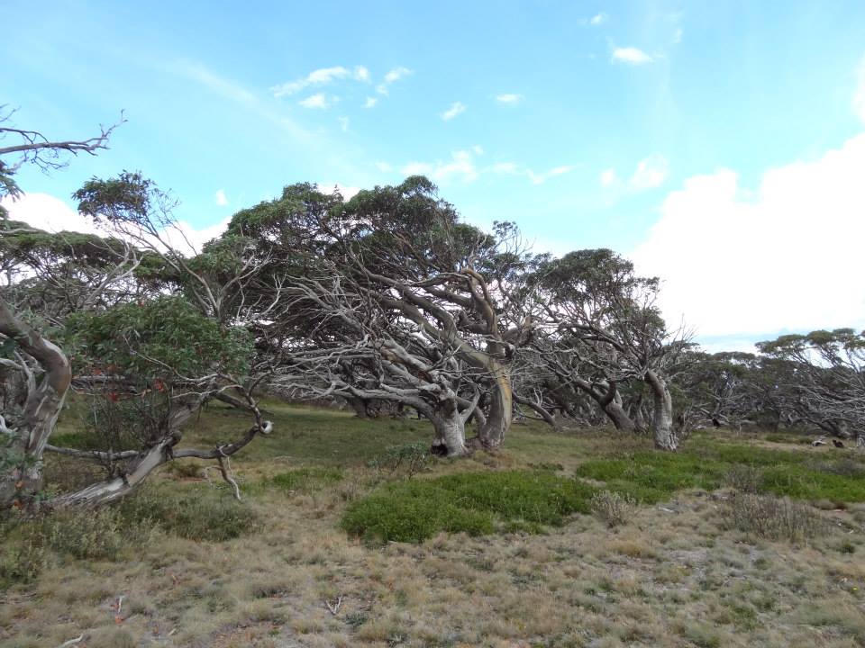
It started well. Although some creativity was needed in places, to stay on the track, it nevertheless took us up a valley, towards a ridge that we could then follow to the summit. About 1km in, the track petered out. Or, more accurately, branched into about 20 different tracks that meandered through some dense heather before each disappearing. The good news was that, while searching for the best way through, I stumbled upon the second of the four species I was looking for. We continued up the hill after collecting some specimens, no longer even attempting to follow a track, until we reached the ridge line. Then the bush-bashing began. The scrub was thick enough to make walking difficult. It was also largely composed of spiky bushes. Within 10 minutes, my exposed knees looked like they'd been jabbed by thousands of tiny needles. We trudged on for a couple of hours, trying to find the best way through the scrub while also keeping generally to the ridge line. Every now and again we would come across a track, but invariably it vanished after a few tens of metres. As the dark clouds moved in, we considered turning back, but the summit was now enticingly close and we continued on. Eventually we stumbled across a track - a real track - the marked track that we should've been following from the start. At the same time we emerged into sub-alpine vegetation, free of scrub, and walking because immeasurably easier. A couple of kilometres of climbing and we were at the summit. The difficulties of the bush-bashing were quickly forgotten as we looked across the spectacular Cobberas Range towards the looming Pilot and the more distant mountains of the Ramshead Range in NSW. Still we had not seen the one species I was desparate to find but, as we packed up our lunch and got ready to head down, a little blue grasshopper jumped out from beside our feet. Excited, I moved to catch it and a chase across several boulders and down from the rocky summit ensued. I won. The grasshopper looked just like the ones from NSW - my big question was answered. With a thunderstorm fast approaching, we were disinclined to linger on the summit, so we hurriedly made our way back down the mountain and, unfortunately, only found one more little blue hopper.
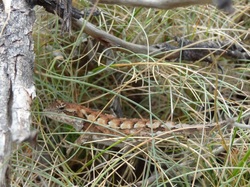
The walk back to the car was uneventful, though extremely well-timed. We left the marked track where we had joined it, to bash our way back through the scrub to the vanishing track we had first followed. It rained on and off while we walked but, as we closed the doors of the car, the heavens opened. We couldn't believe our luck. Not only had we made the summit, found all four species of grasshopper I'd been looking for and seen an elusive Mountain Dragon, but we had missed the downpour by mere seconds. A good day all round. Next time though, I'll follow the proper track!
The following day dawned clear and bright but, with a threat of forecast afternoon thunderstorms, we made an early start. I'd heard that new track markers had been placed along the route up to Cobberas No. 1, the largest mountain in the Cobberas range. I have to admit, that this lulled me into thinking that the track would be easy to find and I didn't read up on the access point like I should've. Vaguely recalling some notes on the track I had read the year before, we drove to the Wilderness Zone entry on the Cowombat Flat Track and started walking, keeping an eye out for tracks leading off towards the summit. We walked. And walked. After 5km, we decided that either we'd missed it, or we'd started on the wrong road. Unwilling to bush-bash through the thick scrub, we turned around and walked back to the car, with a plan to drive back past the campground and see what we could see up the Cobberas Road, which goes up the other side of the range. While driving out, we found what appeared to be a well-formed track and decided to follow that instead, and see where it would take us. It seemed to be heading in roughly the right direction. Armed with a map, a compass and a GPS gadget, we set off.
It started well. Although some creativity was needed in places, to stay on the track, it nevertheless took us up a valley, towards a ridge that we could then follow to the summit. About 1km in, the track petered out. Or, more accurately, branched into about 20 different tracks that meandered through some dense heather before each disappearing. The good news was that, while searching for the best way through, I stumbled upon the second of the four species I was looking for. We continued up the hill after collecting some specimens, no longer even attempting to follow a track, until we reached the ridge line. Then the bush-bashing began. The scrub was thick enough to make walking difficult. It was also largely composed of spiky bushes. Within 10 minutes, my exposed knees looked like they'd been jabbed by thousands of tiny needles. We trudged on for a couple of hours, trying to find the best way through the scrub while also keeping generally to the ridge line. Every now and again we would come across a track, but invariably it vanished after a few tens of metres. As the dark clouds moved in, we considered turning back, but the summit was now enticingly close and we continued on. Eventually we stumbled across a track - a real track - the marked track that we should've been following from the start. At the same time we emerged into sub-alpine vegetation, free of scrub, and walking because immeasurably easier. A couple of kilometres of climbing and we were at the summit. The difficulties of the bush-bashing were quickly forgotten as we looked across the spectacular Cobberas Range towards the looming Pilot and the more distant mountains of the Ramshead Range in NSW. Still we had not seen the one species I was desparate to find but, as we packed up our lunch and got ready to head down, a little blue grasshopper jumped out from beside our feet. Excited, I moved to catch it and a chase across several boulders and down from the rocky summit ensued. I won. The grasshopper looked just like the ones from NSW - my big question was answered. With a thunderstorm fast approaching, we were disinclined to linger on the summit, so we hurriedly made our way back down the mountain and, unfortunately, only found one more little blue hopper.
The walk back to the car was uneventful, though extremely well-timed. We left the marked track where we had joined it, to bash our way back through the scrub to the vanishing track we had first followed. It rained on and off while we walked but, as we closed the doors of the car, the heavens opened. We couldn't believe our luck. Not only had we made the summit, found all four species of grasshopper I'd been looking for and seen an elusive Mountain Dragon, but we had missed the downpour by mere seconds. A good day all round. Next time though, I'll follow the proper track!
 RSS Feed
